
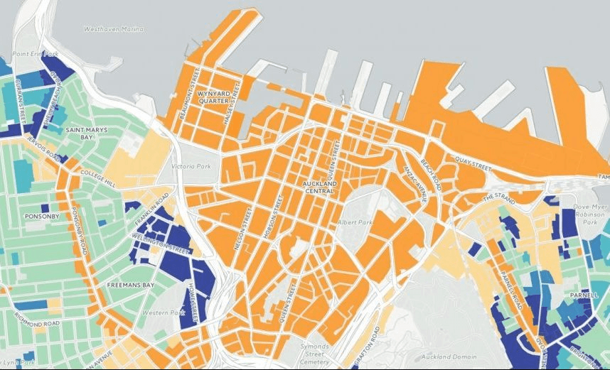


The Spinoff presents a beautiful way to see what the new rulebook provides for your street, neighbourhood, and the city as a whole
The Spinoff’s War for Auckland bunker is shaking with excitement today as we publish a bold and beautiful bunch of accessible, zoomable maps to illustrate the Unitary Plan.
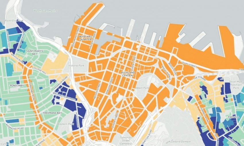
Using data sets provided by the Auckland Council, visualisation wizard Chris McDowall has built a stunning series of maps that make it easy – engrossingly so – to look at the way your street, your neighbourhood, and Auckland at large will look, as set down in the latest iteration of the Unitary Plan. Click here to view the full glory, or go directly to Central Auckland, the West, the East, the South, the North Shore or Rural Auckland.
NB these maps are based on the version of the Unitary Plan as redrafted by the IHP and do not therefore incorporate the recommendations of Council staff.