
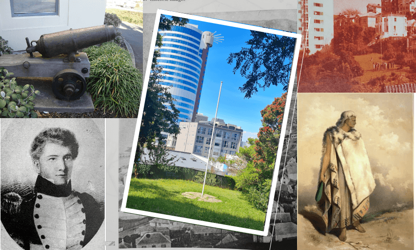


Wellington’s Flagstaff Hill has a strange, dark history…. or does it? Max Rashbrooke uncovers the truth about a historical myth.
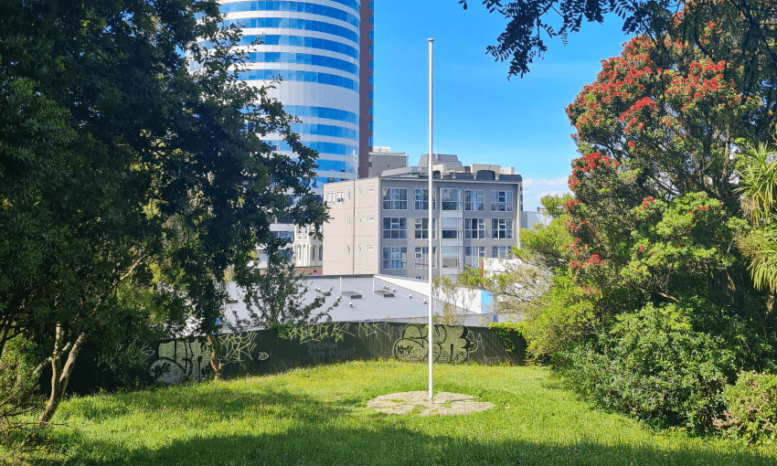
I pass it almost every day, yet never see it used. The flagpole, placed on a grassy hill above Wellington’s CBD, surrounded by trees and houses, and accessible only by a labyrinth of pedestrian walkways, seems not to serve any function. But it does have a strange and knotty past, as well as an inadequate present.
Its location, Flagstaff Hill, is a sloping parcel of land above the St George Hotel on Boulcott Street, bounded on its other three sides by the Terrace, the Dixon Street state-housing complex, and a sheer drop to the Willis Street Village complex. Largely unknown, it is little more than a patch of lumpy grass, perhaps 40m on each side, dotted with shrubs and rubbish, and containing, most obviously, the flagpole.
Having passed it so often, on my regular walks into town, I began to wonder: what purpose did it serve? Researching its history, I was intrigued – and disturbed – to read news stories implying it had been part of a bizarre defence system for the first European colonists. In 1843, in an incident given the rather vague title of the Wairau Affray, 22 settlers were shot dead by Ngāti Toa fighters several miles north of Blenheim. In response, alarmed Pākehā decided they needed an early warning system. “After the Wairau Affray,” the Dominion Post noted in a 2017 story about Flagstaff Hill, “settlers established a series of flagstaffs in Wellington to warn of impending Māori attack. The first recorded flag was raised on the site in 1857.” A Wellington City Council press release of the same year claimed cannons had even been mounted onsite.
These stories had a disturbing undertone because, contrary to Pākehā belief at the time, it was the settlers themselves who were largely responsible for the “Affray”. Attempting to evict Ngāti Toa leaders from land the latter had steadfastly refused to sell, the armed posse of settlers appear to have sparked the carnage by shooting dead the wife of one of the rangatira. The phrase “white fragility” can be overused, but the Wellington response to the “Affray” – a mass panic by the very people responsible for the problem at hand – was surely a prime instance.
Something, though, troubled me about these newspaper accounts of Flagstaff Hill: they didn’t cite any primary sources. Just to be on the safe side, I started searching Papers Past, the online newspaper archive, and consulting books at the Wellington City Library. These sources hinted at a high degree of confusion as to where “Flagstaff Hill” actually was.
A trip to the council archives then cleared everything up: it’s the wrong hill.
A detailed report by heritage consultant Michael Kelly, prepared for the council in 1997 and based on archival records, noted that in colonial Wellington, multiple flagpoles were erected; accordingly, multiple spots were known as “Flagstaff Hill”. The one that appears to have been used to warn of “impending” Māori attacks, and where settlers mounted two 18-pounder guns they had taken from Matiu/Somes Island, was a hill known then as Clay Point, which sits above the junction of Willis Street and Lambton Quay, a spot now referred to as Stewart Dawson’s corner. It is only a few hundred metres north of modern-day Flagstaff Hill – but it is a completely different place.
How had this geographical error occurred? Kelly’s report argued that, in the 1920s, the location was still being correctly identified, but by the 1948 publication of Fanny Irvine-Smith’s The Streets of My City, the “myth” about modern-day Flagstaff Hill “had become entrenched”. The council’s recent records show just how quickly confusion can regain the upper hand. A late-2000s memoranda from council staff, attempting to summarise Kelly’s report, bizarrely repeats the myth that the hill was used as a gun emplacement. The message, long familiar to historians, is simple: always check the primary sources. And read things carefully.
The pole that gave Flagstaff Hill its name was not, in the end, a very interesting erection. It appears to have been raised by the Houghton family, early settlers who lent their name to one of the southern bays. Deeply involved in maritime activities, they lived on Flagstaff Hill, and may have run flags up the pole to inform the nascent port’s inhabitants about ship arrivals. The flagpole’s erection, Kelly wrote, was “likely … linked to the commercial activities of the Houghton family”.
As the city evolved, so too did Flagstaff Hill. In the 1920s, responding to complaints about the steepness of the path up the slope, the council acquired part of the hill in order to build a cable car from what is now the Willis Street Village to the top of the current cable car, passing under the Terrace “at a depth of 90 feet”. The plan was dropped only when it turned out that “newly improved” buses could manage the climb.
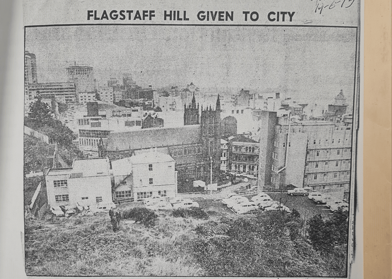
The hill then passed through various hands, including those of New Zealand Breweries and Massey University. The site of the original flagstaff became a car park in the 1970s, and is now covered in townhouses. Ironically, the current flagpole, erected in 1973 to commemorate the restoration of “historic Flag Staff Hill”, according to its bronze plaque, is some 50m away from the original spot.
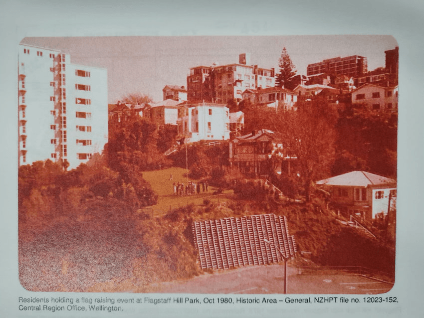
From the early 1970s onwards, the council leased the current grassy area, maintaining it as open space. It was regularly used for events organised by the Flagstaff Hill Area Residents’ Association, which even had a flag that it would raise “on occasions of neighbourhood festivities”, in the words of Neil Prior, its former chairperson. City councillor Iona Pannett, who grew up on the hill, recalls a “really awesome” neighbourhood that sported a community garden and allowed children to run free, and where the adults held progressive dinners. But with the decline of the association, regular use of the flagpole – and indeed the open space – seems to have petered out.
Nonetheless, in 2015, the council bought the land from a couple, Mike and Gay O’Sullivan, who had built the nearby townhouses and obtained planning permission for a further dozen on the hill, but then had a change of heart. The sale, the Dominion Post reported, had gone through on the basis that the land be kept as a reserve. (Returning it to its original mana whenua owners does not seem to have been contemplated.)
In the run-up to the purchase, several councillors got lost on their way to a meeting at the site, raising – not for the first time – questions about their general levels of competence and professionalism. Undeterred, one councillor, Helene Ritchie, enthused about the site’s potential, predicted it could become an outdoor theatre space or a community garden.
It feels almost redundant to state that none of those things happened. Now, the land just sits there, largely unloved, providing nothing more than a spot to read or eat lunch for a vanishingly small number of users.
When contacted by The Spinoff, the council did not appear to have any plans to improve the site. But could other uses for it be found? Housing is out. So too, in all probability, a playground: the stroller access is awful. But how about a natural enhancement? The hill could host an orchard of fruit trees, or a glade of native specimens, supporting the halo effect of kākā and kererū spreading from Zealandia, the Karori wildlife sanctuary. Or, as Ritchie envisaged, a community garden for a post-renovation Dixon Street flats.
The current failure to adequately use the site speaks to a certain neglect of public space. In an ideal world, public bodies are problem-solvers, finding potential in languishing sites and, in conjunction with their communities, building something better. This spirit, though not totally absent in Wellington, is hardly at its greatest height. The result is a desperately underused space punctuated by a largely redundant flagpole – a phallic symbol, like all such things, but not an especially virile one.