

Digital maps are highly convenient, but what do we lose without the art of handmade cartography? Shanti Mathias explores for IRL.
“A map is a magical line that locates you in the world,” says Donald Preston, a visual design lecturer at Massey University. Like a GPS, I suggest: the dot that is your body rendered bright against the pixels of your screen. “The idea of the word map has changed,” he replies, sighing. “I’ve got over seeing [digital maps] as the devil; they’re terribly useful in their way.” Preston has loved maps all his life, and did his masters in the “emotive cartography” of maps – how we feel about the way that maps represent our world.
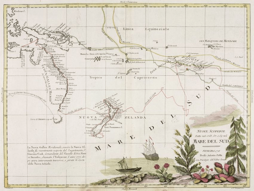
For thousands of years, humans have drawn maps to represent the world. Until the last few decades, those maps were always static; you could flip through the pages of a road atlas but you had to know how to read a map to correlate your location with the paper. Now, though, GPS technology is ubiquitous, the solid smooth cellphone in everyone’s pocket communicating with satellites orbiting thousands of kilometres above the land, locating you to an accuracy of 10 metres or less.
Maps are perhaps one of the most visible ways that the online world has real world consequences. In the 17 years since Google acquired Australian company Where 2 Technologies and launched Google Maps, digital maps integrated with GPS have become available on almost all smartphones. Consequently, our relationship to maps has completely transformed.
Digital phone apps are good for many things. Finding your way through an unfamiliar city. Discovering local businesses. Estimating how long it will take you to get somewhere. Generated by a mix of satellite data, cars with cameras, and surveying usually done by governments, these maps work exceptionally well in urban areas. Beyond that, though – anywhere the cellular network is patchy, or the named streets few – these apps are less useful.
In October 2020, for example, Radio New Zealand reported that farmers across Aotearoa were being confronted by strangers wandering through their land, because Google had failed to mark their roads as private. “Someone came through in the middle of the night [and] managed to reverse into a drain then they had to get out to get help,” farmer Fiona Hastie told Katie Todd. “They shouldn’t have been there in the first place.” Google had apparently decided that the roads were public from satellite images and location data. Google and Apple Maps are products optimised for urban areas, but don’t convey other useful information about land, like ownership boundaries or the shape and location of hills.
For those who spend time outside of cities, locally designed apps with locally designed maps are important. “I’ve always loved topo[graphic] maps,” Stephen Tallon says. Tallon is the man behind Right Place Resources, the developer of Android and Apple apps that provide fully offline copies of the LINZ maps of New Zealand. These apps are popular; Tallon estimates that 1% of the New Zealand population has downloaded them, with the South and North Island at #1 and #2 in the App Store for navigation respectively.
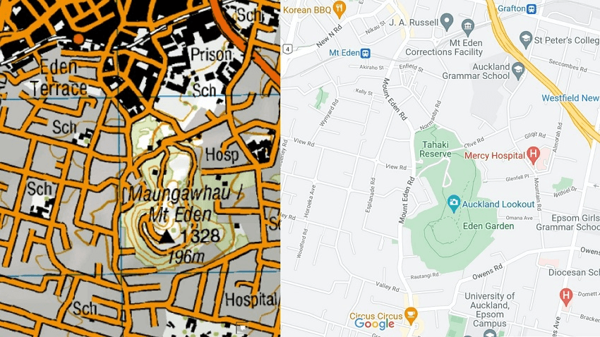
The topographic maps LINZ produces have contour lines, showing how steep hills are. They also indicate types of land – a forest, an icy glacier, a sandy riverbank, a swamp – and tramping hut locations. This is a different kind of information to the flat, bland features of the default Google and Apple Maps that come loaded onto most smartphones.
“It’s a lovely way of showing information you don’t get from a street map,” Tallon says. His apps are mostly used by trampers and hunters, with overlays available to show hunting permit areas. Unlike Google and Apple, Tallon doesn’t gather any of a user’s location data, though users can add waypoints or mark routes to customise the maps for themselves.
“My research was a boring old love affair with cartography,” says Preston, the design lecturer. It was the art that spoke to him, but the semi-automatically generated digital maps leave him cold. “There’s no desire for aesthetics. It is practical, but it’s not easy to read – aesthetics engage you with a map.” He acknowledges that digital maps can be objects of beauty, but they aren’t usually the ones used for navigation.
Tallon, who originally created his map apps so that he could have topographic maps on his phone, agrees. “There’s that handcrafted element of beauty in the [topographic] map that makes information easier to understand,” he says, a je ne sais quoi that is lost in standard apps. To look at a street map of your city might be very helpful for visiting a friend’s new house, but will give you little information about the land you traverse to get there.
That said, maps – topographic or standard – are powerful safety tools, and Tallon says that many search and rescue teams use his app. Lots of search and rescue missions are because people get lost, he says, not because they’re stuck. “You can largely eliminate that with maps and a GPS.” Even in cities, knowing where you are can be immensely useful if you need to find someone else, or return home.
Ultimately, maps are a way to learn how to navigate the world. Does the pervasiveness of digital maps change how people explore? “I wouldn’t find my way through a [new] city with a map,” Preston says. Instead, “I’d explore, then think about it afterwards”. He worries that when everyone has a map in their pocket there is no compulsion to discover.
But perhaps the opposite is true. A shiny GPS circle on your screen situates you, Tallon says, so that “you are more connected with your environment”. Knowing where you are offers the confidence to traverse new places. “A map lets you see what’s there that might be beyond the horizon,” he continues. Explore first the map, then the world.