Is this the Harbour Bridge crossing breakthrough Auckland has been waiting for? And what does it mean for SkyPath?
This post was first published on Bike Auckland.
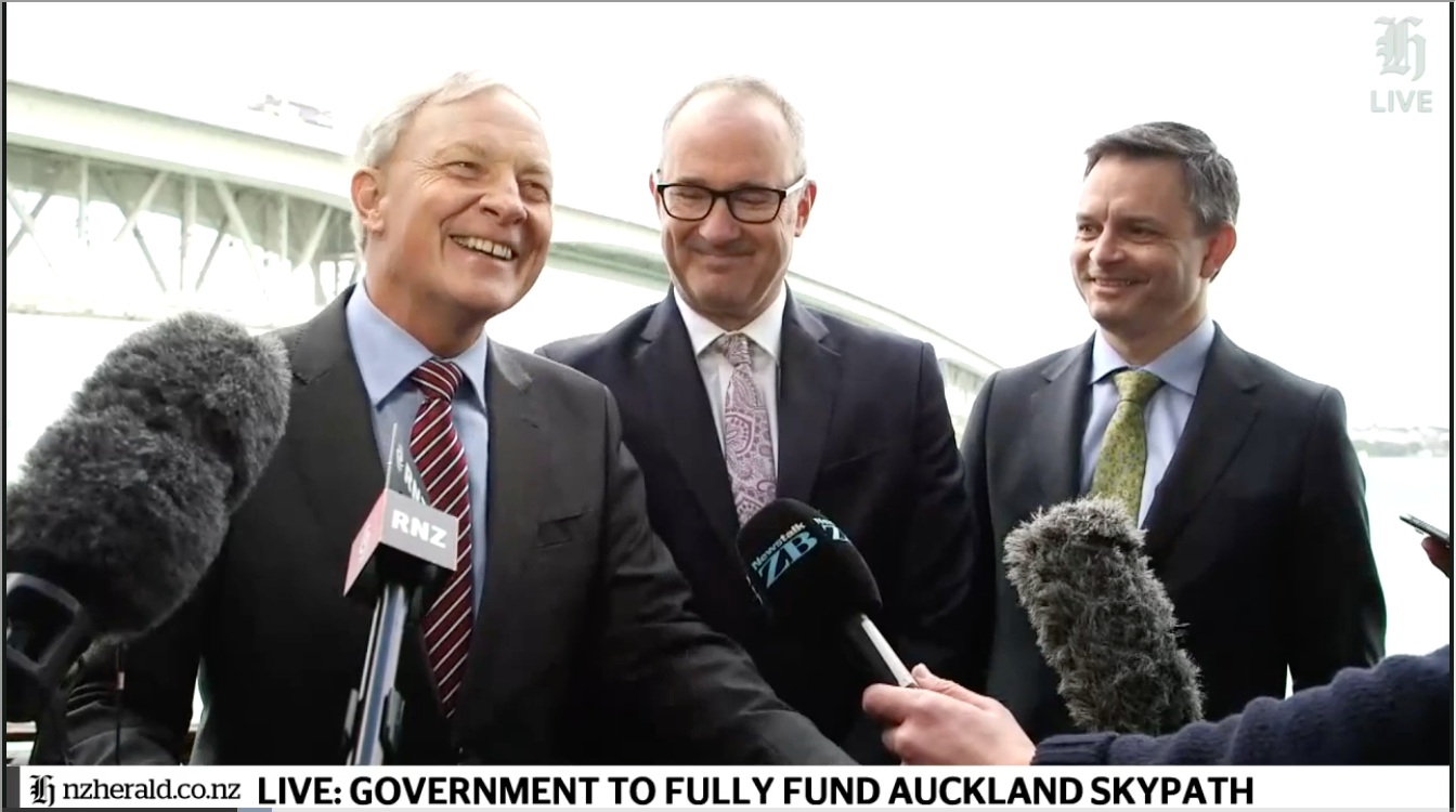
Today the NZ Transport Agency unveiled its preferred design for a walking and biking pathway across the Auckland Harbour Bridge, breaking the silence around the project since the government confirmed last August it would fund the crossing.
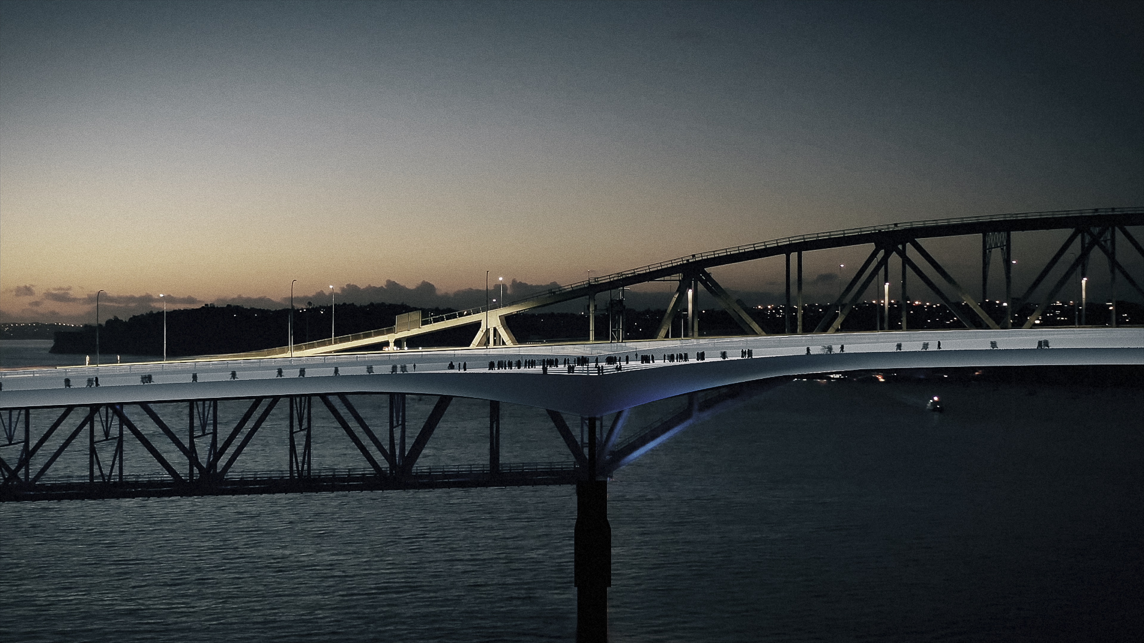
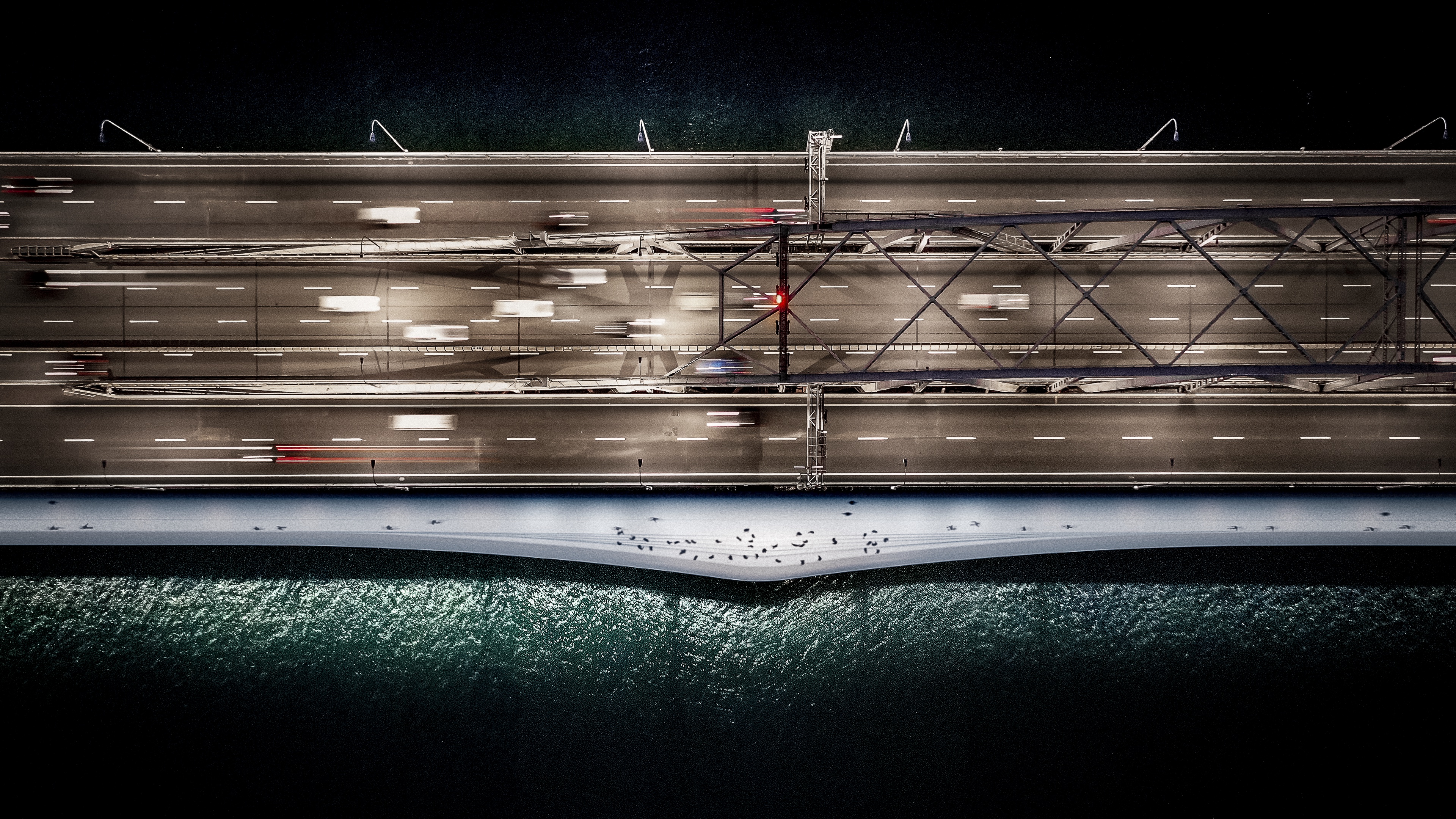
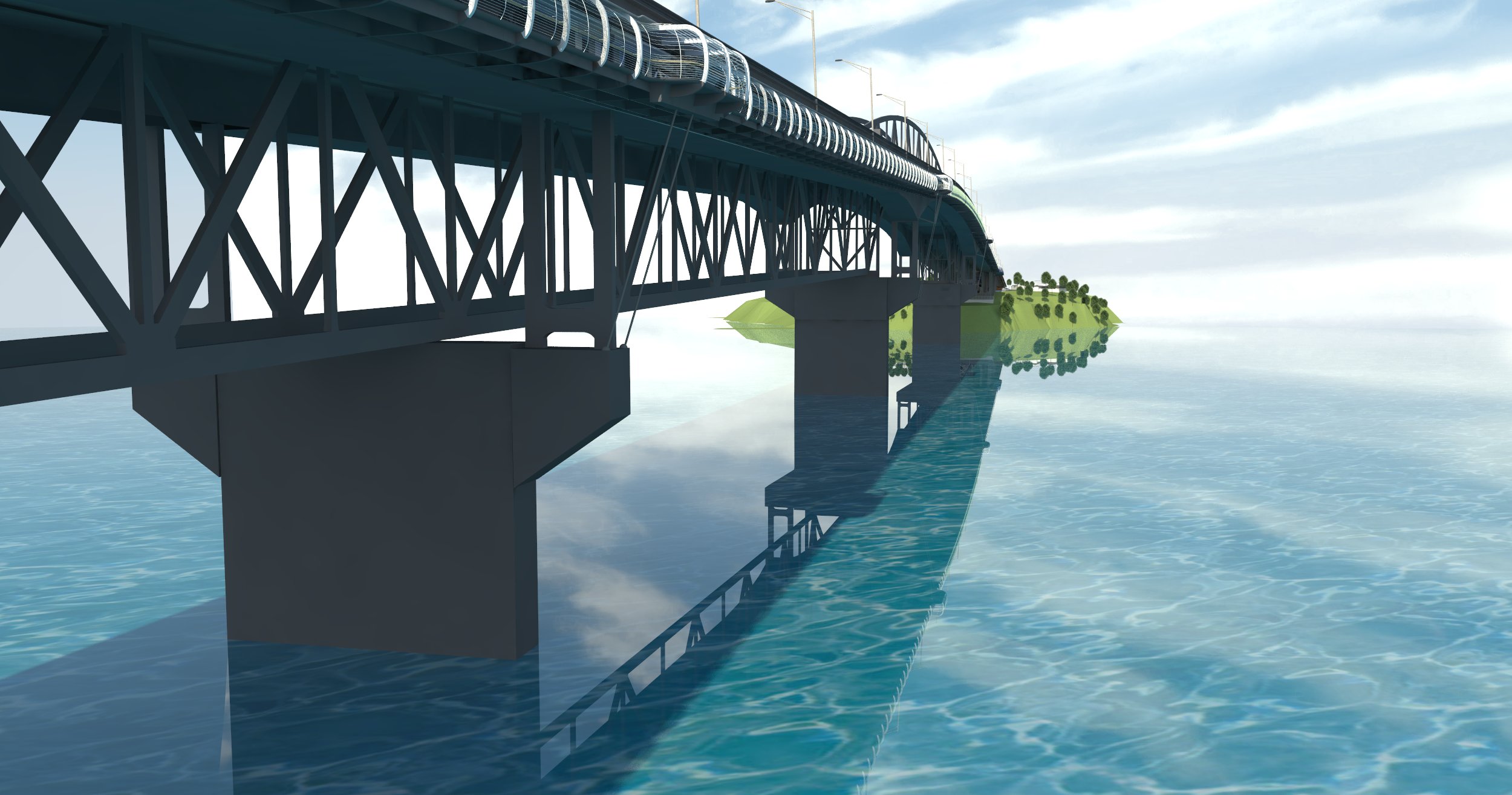
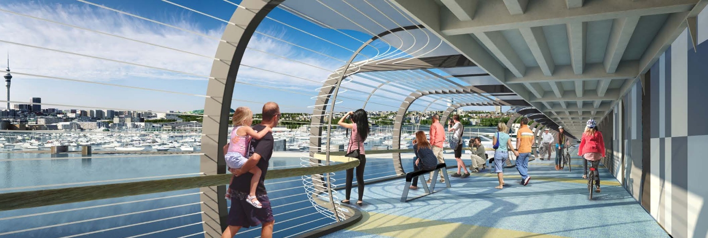
Initial images show a pathway along the city side of the bridge: it’s cantilevered off the piers, and roughly level with the roadway. According to the official media release, the path echoes the shape and design of the existing bridge, with a five metre wide travel width, and three wider and spacious terraced galleries about 100m long, stepped down from the walkway and cycleway, creating a natural seating area where people can gather or pause to take in the views.
Crucially, the announcement notes that because this pathway will be attached to the bridge piers rather than the clip-on, that means “no restrictions on the number of people who can access the path at one time, and it is designed to cater for future demands”. The Transport Agency’s general manager of system design and delivery, Brett Gliddon, says construction could begin as early as next year.
This is great – but wasn’t it all sorted already?
You can be forgiven for wondering how many times an announcement can be made that a connection across the bridge is imminent. Ever since the 1946 Royal Commission proposed a harbour crossing ‘with footpath and cycle-track’ included, we’ve yearned to walk and bike from one side of the harbour to the other. It’s been a long, LONG road. We’ve been keeping our powder dry but we’ve almost run out of fireworks.
This time is different.
Until now, all eyes have been on SkyPath, the extraordinary citizen-led campaign to bridge the most glaring gap in our biggest city’s transport network, which against all odds – and with the support of thousands of Aucklanders, as well as private backers and Auckland Council – delivered an innovative design that won resource consent in 2015 (which was upheld on appeal in 2016).

Then, the incoming coalition government promised to fund the missing link across the bridge, and after the 2017 election the job of delivery moved into the hands of the NZ Transport Agency, which administers the bridge.
SkyPath demonstrated what we knew all along: that it could be done. NZTA’s design released today suggests how it will be done. Above all, it must be done.
For every ordinary Aucklander, and every visitor to our city, the question has always been a very simple one: when can we walk and bike across the bridge? Two decades into the 21st century, with climate action, transport resilience and public health urgently on our minds – and a growing bike boom on our hands – the question has become: how is this even still a question?
What do we want? To get across! When do we want it? Preferably several decades ago, but now’s good!
Today’s announcement represents an important breakthrough – with a few caveats. Pictures aren’t plans, but the imagery and information released today allows us to see what questions the design answers – and what’s still up in the air. Real certainty will come as we learn details about the landings at both ends, and get clarity on whether the current consent can be leveraged to ensure swift delivery.
Aucklanders are tired of the decades of delay and doubt, so the pressure will now really be on the Transport Agency to get on with it, move past any remaining roadblocks, and deliver this vital link.
What this new design means
Let’s be upfront: it’s impossible not to compare the new design with SkyPath, the name that has been synonymous with a pathway over the bridge for most of the last decade.
SkyPath emerged from the protests at the 50th anniversary of the Auckland Harbour Bridge. Recall, the official line at that time was that there was no hope of a walking or biking path across the existing bridge, and that we’d all simply have to wait for the next harbour crossing to happen. Case closed.
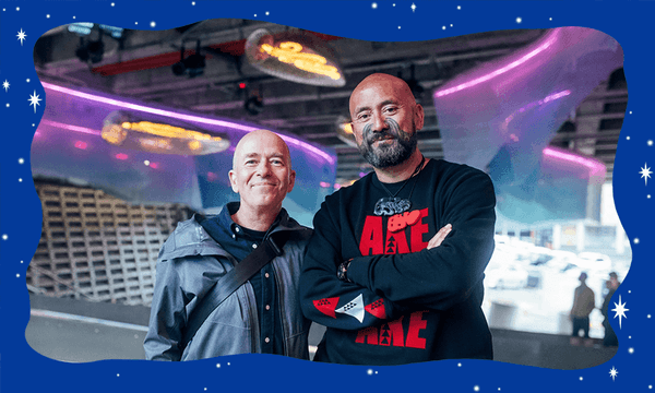
Refusing to take no for an answer, Bevan Woodward and the GetAcross team set out on a quest to prove the naysayers wrong. And because New Zealanders love a story that starts with the words ‘they said it couldn’t be done’, thousands of people threw their support behind the vision, from expert engineers to ordinary citizens.
The result, SkyPath, was a brilliant design solution that responded to, grew out of, and then grew around a set of key constraints. It had to attach to the clip-on to stay within the tight budget of a citizen-funded project. It needed to be light to minimise loading on the clip-on. This led to an innovative approach of using composite material. Because it was light, it needed to be alert to the load it carried, i.e. how many people could use it at once. And because it attached below the clip-on in the form of a tube, access was limited to each end.
Every step of the design logic made sense under the conditions and passed the stringent requirements for resource consent. SkyPath was not just the leading contender for a successful pathway, it was the only contender.
(It’s impossible to overstate what an achievement this is in itself – it’s as if citizens had come together to invent the InterIslander ferry after being told it couldn’t be done. Someone best be getting the film rights.)
Then the NZ Transport Agency re-entered the picture in a positive way after the incoming coalition government pledged to take on the project and fund it. Of course, if a previous government had stepped up to respond to the task of satisfying public demand and fixing this strategic gap in the network, the Transport Agency would have been instructed years ago to deliver the Harbour Bridge.
The reality is it needed the public’s investment in SkyPath plus firm government direction to spur them into action.
We now know the Transport Agency has been investigating a range of options over the last while – during what has been a very, very turbulent time for the organisation – and the outcome is this new design.
By going back to first principles, and unfettered by the previous constraints, the new design can address issues that had seemed locked into place. In a crucial contrast to SkyPath, the design is cantilevered to rest on the piers, i.e. the enormous stone footings of the bridge, rather than depending entirely from the box-girder structure itself.
This in turn opens up many more possibilities. Because weight is not such an issue, the pathway can be made of more familiar and readily available materials like steel. Because it can sit closer to the level of the road, there’s more access as needed for maintenance or emergencies. Above all, it’s wider, allowing the possibility of enough space for everyone who wants to use it, now and well into the future.
Width is key
We’ve always known a path over the bridge would be incredibly popular with locals, with visitors, with tourists, for daily journeys and weekend adventures. Within the last few years Auckland’s seen an explosion in the range and variety of people on wheels, with the advent of electric bikes and family cargo bikes; e-scooters, hoverboards and mobility devices of all kinds. We’ve also watched daily bike commute numbers rise by 20~25% a year wherever paths are safe and connected.

In years to come, we’re going to need a path wide enough to ensure a safe and continuous flow of travellers on wheels and on foot, while also making room for people to pause and admire the view of our sparkling harbour and volcanic landscape and city skyline. If the history of the bridge itself tells us anything, it’s: don’t underestimate demand. This design looks set to tick that box.
So, what next? When can we ride?
You’ll have as many questions as we do, especially about timing and legalities. Like us, you’ll want to know specifics about the widths and materials, the shape of the viewing areas and whether they’re covered, and the details of the landings at each end, as well as questions around operating hours and all the many other issues that were canvassed along SkyPath’s road to the Environment Court and resource consent.
The onus is now on the Transport Agency to clarify these issues as it proceeds to detailed design.
In particular, we’ll want to know about whether the existing resource consent can be leveraged, with conditions varied as necessary, to ensure as swift a delivery as possible.
Because the last thing any of us wants is to turn the clock back a decade and start entirely from scratch. With everything we now know about climate, health, resilient networks – and with the growing bike boom – certain and swift completion of this missing link is the highest priority. The Agency is talking about construction beginning as early as next year, i.e. 2020. Let’s hold them to that!
(Not to get ahead of ourselves, but: one thing we do know from Lightpath, which went from twinkle-in-Max’s-eye to actual pink path in just over a year, is that when the road ahead is clear, NZTA can build at pace!)
And what about SkyPath?
A decade of work isn’t something to let go of lightly; especially when you have fought the good fight against stony-faced officialdom that insisted it couldn’t be done. On the other hand, officialdom has now risen to the challenge with a design that’s fully fit for the future, and is eager to deliver.
So it’s time to parley. Because the other part of today’s announcement was the result of an inquiry into NZTA’s correspondence with the SkyPath Trust, acknowledging that the agency “could have communicated sooner that it was looking at alternative options.”
There are clearly loose ends to be tied up on that score, and we warmly encourage the Agency and the SkyPath Trust to work together to reach a resolution of any outstanding issues.
Whatever happens next, the story of SkyPath will forever stand as an inspiring example of ingenuity, passionate dedication, and a sheer determination.
Today’s design ultimately rests on the inspirational leadership and visionary momentum generated by thousands of dedicated volunteer hours of energy, expertise, and public spirit thanks to the GetAcross Campaign and the SkyPath Trust. We also credit the unflagging support of the people of Auckland over the years, and this government’s commitment to delivering a harbour crossing as a proud legacy for our city.
Plus, good luck getting everyone not to call the eventual crossing “SkyPath”! The name is synonymous with Auckland’s aspirations to be able to walk and bike over the bridge, and it will live on as enduring testament to the courageous legacy of Bevan Woodward and his tireless warriors over the years, who knew it could be done. They were right.
What about the planned protest on Sunday?
That’s in the SkyPath Trust’s hands, and we’ll keep you updated on developments.
Update, 5am Wednesday. The SkyPath Trust have issued the following statement:
“We’ve made the decision to call off the SkyPath rally, here’s why…
“We’ve had a productive meeting with NZTA today (our first meeting in 6 months!) We have agreed to commence a facilitated process to rebuild our relationship, to resolve the issue of SkyPath’s IP and support the new design put forward by NZTA. On this basis we think it is appropriate to call off the SkyPath rally planned for this Sunday.
“We don’t like to mess people around but the developments today came as a surprise – and ironically as a result of our plan to rally. We now welcome the opportunity to work with NZTA to help deliver a remarkable facility for Auckland.”