


Auckland Council, the Crown and tangata whenua are proposing a formal deed of acknowledgement to help guide the protection of Te Wao Nui a Tiriwa.
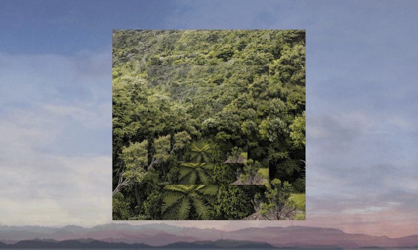
For many West Aucklanders, growing up meant having the Waitākere Ranges – also known as Te Wao Nui o Tiriwa – at your back door. Long afternoons spent popping manus into waterholes off muddy tracks, exploring the bush beneath towering kauri, and watching the sun drop behind the surf along the coast. The ngahere – thick, damp, and full of life – was both a playground and a sanctuary.
Now, nearly two decades after the area was formally recognised in law as a heritage area, the Crown, tangata whenua and Auckland Council are proposing a formal agreement to protect and steward this place together.
What is the Waitākere Ranges Heritage Area?
The Waitākere Ranges Heritage Area spans more than 27,000 hectares of forest, coastline and small communities in West Auckland, including the 17,000-hectare Waitākere Ranges Regional Park. It’s one of the most biologically and culturally significant landscapes in the country – home to dense native ecosystems, ancient walking tracks, and a living connection between tangata whenua and their ancestral lands.
This significance was recognised in 2008, when parliament passed the Waitākere Ranges Heritage Area Act. The act was designed to protect the area’s “heritage features”, including its diverse ecosystems, landscapes, cultural sites, and the long-standing relationships tangata whenua have with the whenua.
One of the most pressing challenges in recent years has been kauri dieback, a soil-borne pathogen threatening the iconic native trees. In 2017, Te Kawerau ā Maki placed a rāhui across forested areas of the ranges to help stop its spread. Auckland Council followed with formal closures in early 2018. These decisions were made in collaboration with Te Kawerau ā Maki and the Department of Conservation, reflecting a shared commitment to protecting the area’s ecological and cultural integrity.

The 2008 act also allowed for the creation of deeds of acknowledgement – formal agreements that recognise the special relationship of mana whenua with the land, and outline how they can contribute to its management.
Seventeen years later, the first such deed is now on the table.
What is being proposed?
At the heart of the current proposal is a formal agreement – known as the Waitākere Ranges Heritage Area Deed of Acknowledgement – being developed between the Crown, Auckland Council, and tangata whenua, specifically Te Kawerau ā Maki. Discussions are also ongoing with Ngāti Whātua regarding their potential involvement.
The deed is grounded in the Waitākere Ranges Heritage Area Act 2008 and sets out how these parties might work together to care for and enhance the area. It acknowledges the deep cultural, spiritual and historical connection tangata whenua have to the land and aims to support the long-term stewardship of its natural and cultural values.
The proposed deed would:
- Formally recognise tangata whenua relationships with the heritage area;
- Outline how the Crown, Auckland Council and tangata whenua can work together to manage and protect it;
- And identify practical opportunities for tangata whenua to contribute to the care and management of public land.
In December 2024, Auckland Council agreed in principle to four key elements of the proposed deed:
- Developing a long-term strategic plan for the heritage area;
- Creating a coordinated work programme to deliver that plan;
- Establishing joint monitoring and reporting of progress and outcomes;
- And forming a joint decision-making committee, under the Local Government Act 2002, with 50% representation from tangata whenua and 50% representation from Auckland Council and the Crown.
Importantly, the deed:
- Applies only to public land owned or managed by the Crown or Council;
- Does not affect private land or water;
- And does not override existing governance structures or statutory powers.
Instead, it’s designed to support better coordination, transparency and long-term partnership between the parties involved.
How is the area currently managed?
The Waitākere Ranges Heritage Area is managed by Auckland Council, with support from the Department of Conservation and input from community groups, volunteers and tangata whenua.
The current management framework is based on the 2008 act, which set out the area’s heritage values and established legal responsibilities for their protection. Following the 2010 local government amalgamation, Auckland Council inherited the functions of the former Auckland Regional Council, Waitākere City Council and Rodney District Council. Today, it oversees the Waitākere Ranges Regional Park, monitors environmental outcomes, and updates park management plans.
Te Kawerau ā Maki are regularly consulted on decisions, but no formal shared governance structure exists. The proposed deed is intended to change that – not by transferring ownership or statutory power, but by creating a more structured and enduring framework for cooperation, with tangata whenua recognised as active kaitiaki.
Why now?
Seventeen years on from the passing of the act, Auckland Council says the time is right to deliver on its intent.
Councillor Richard Hills, chair of the council’s Planning and Environment Committee, describes the deed as a way to formalise the collaboration already happening between tangata whenua, local communities, rangers and volunteers.
For Te Kawerau ā Maki, the deed reflects their long-standing role as kaitiaki and signals a move toward shared decision-making that benefits both the whenua and those who use it. Council’s tumuaki huanga Māori, Nick Turoa, has called it an opportunity to honour past promises and build a shared long-term plan for the future.

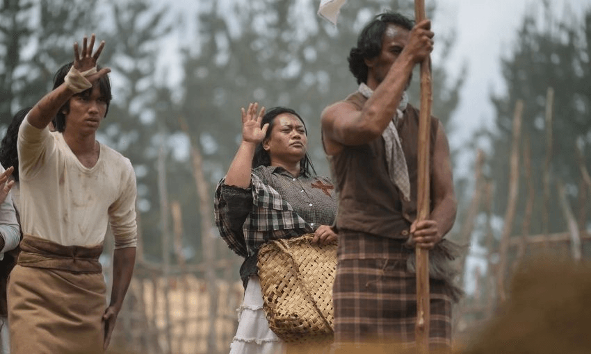
The Waitākere Ranges have been inhabited and cared for by Māori for centuries. The 2008 Act includes the words of Te Waatarauihi, a rangatira who spoke at the 1860 Kohimarama Conference. His kōrero described the ranges as inseparable from the life of his people – land handed down by ancestors who had walked its ridgelines long before Auckland existed.
For tangata whenua, that relationship is not symbolic. It’s exercised daily through the practice of kaitiakitanga.
The deed goes beyond acknowledgement. With 50% representation proposed on a joint committee, it offers the foundation for genuine co-governance. While details of the committee’s role are still being developed, it would represent a significant step toward shared decision-making.
Similar models already exist across the motu. The Waikato River Authority, for example, has equal representation from iwi and Crown appointees and plays a statutory role in river health. In Te Urewera, governance is shared between Ngāi Tūhoe and the Crown through a board that manages the area as a legal entity in its own right. While the Waitākere proposal doesn’t go that far, it reflects the broader shift toward embedding mana whenua in the governance of ancestral lands – not as advisors, but as partners.
Is there any opposition?
Yes – not everyone supports the proposal.
Earlier this month, the group Walk, Tramp, Run – which represents recreational users of the ranges – circulated a letter to Auckland tramping clubs urging individuals to oppose the deed. The group argues that a joint committee with equal tangata whenua representation could conflict with the intent of the 2008 act, which they interpret as limiting executive authority for any single group.
What happens next?
It’s important to note that the decision to develop a deed of acknowledgement has already been made. Auckland Council has stated clearly that consultation is not about whether or not to have a deed – that was provided for under the 2008 act. Instead, feedback is being sought on what the deed should contain and how it should work – including the strategic plan, work programme, monitoring framework and the role of the joint committee.
Consultation is open until Monday April 28. Feedback will be analysed and presented to Auckland Council, with final decisions expected in July or August 2025.
This is Public Interest Journalism supported by NZ On Air.